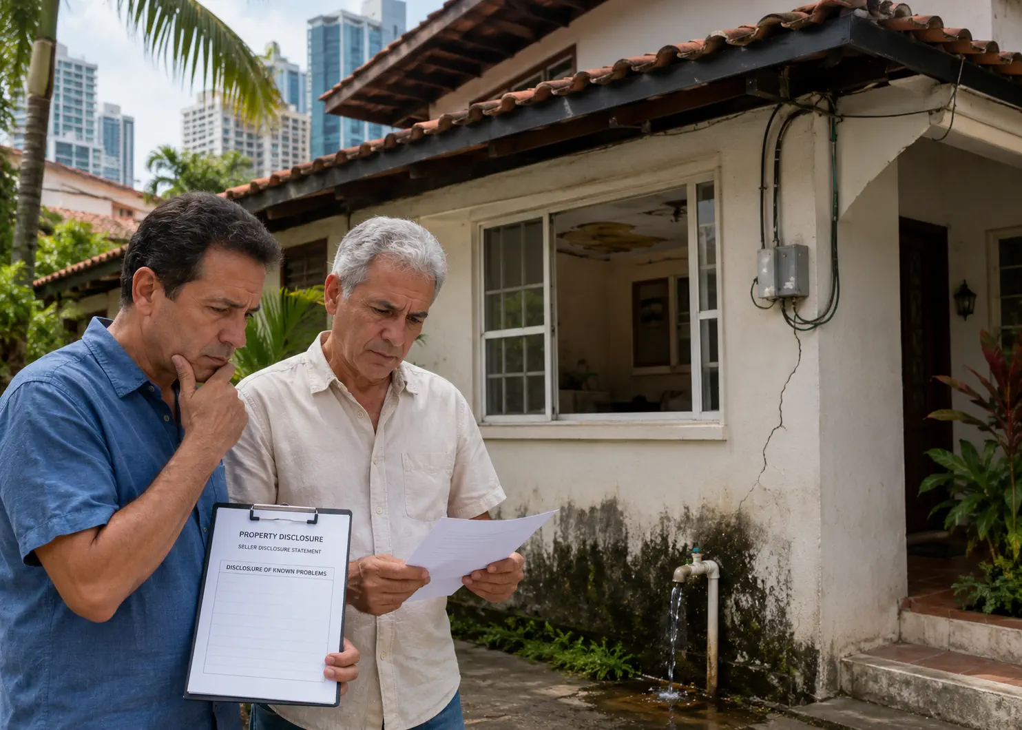
Buying Property in Panama · Part 4 of 10
What Sellers Don’t Have to Tell You: Flooding, Landslides, Zoning, and the Other Things Panama Buyers Discover Too Late
Panama has no seller disclosure form, no FEMA flood maps, and no obligation to mention the 15-story tower approved for the lot next door. Here’s what you need to find out yourself — and how.
 Brian & Kent · GayExpatsPanama.com · April 2026 Research Trip
In the United States, buying a house comes with a stack of disclosure forms. Has the property flooded? Are there known defects? Is there anything pending that might affect value — a rezoning application, a road project, a neighbor’s approved construction? The seller signs forms. The agent signs forms. There are legal consequences for omissions. In Panama, almost none of this exists. The seller has no legal obligation to volunteer that the empty lot next door has an approved permit for a 15-story condominium tower. There is no FEMA flood map to look up. There is no standardized disclosure process at all. Expats who have bought here consistently describe being startled by how little paperwork was involved compared to a US closing. We haven’t bought property yet. We’re researching this as part of our own preparation, and what we’ve learned is that the burden of discovery falls entirely on the buyer — and the things worth discovering are not obvious if you’re arriving from a country where the system finds them for you.
Buying Property in Panama: The Complete Expat Guide
Ten articles covering everything from the rent-vs.-buy decision through closing day and beyond — including the specific issues that affect gay couples that most guides completely ignore.
- What to Think About Before You Think About Properties
- What Are You Actually Buying? Titled Property, ROP, Concessions Explained
- Finding a Real Estate Agent — and How to Tell If They're Working for You
- What Sellers Don't Have to Tell You: Flooding, Zoning & Hazards You are here
- The Promise to Purchase: What to Negotiate Before You're Committed
- Due Diligence: Title, HOA Health & the Inspection Nobody Does
- Closing: Costs, Taxes, the Public Registry & What Happens on Day One
- Corporate vs. Personal Ownership: When a Panama Corporation or Foundation Makes Sense
- Managing Property from Abroad: Rentals, Property Managers & the 45-Day Rule
- Buying Property as a Gay Couple: Title Structure, Legal Documents & What Marriage Doesn't Protect Here
The Disclosure Gap: What Panama Doesn’t Require Sellers to Tell You
Panama’s Civil Code places responsibility on the buyer to investigate the property they are purchasing. The doctrine of caveat emptor — buyer beware — is closer to the operating reality here than in most U.S. states. There is no standardized disclosure form, no MLS with mandatory data fields, and enforcement of broker licensing is uneven enough that accountability varies widely from agent to agent. Some agents are excellent and will surface everything they know. Others will not.
What this means in practice is that if a seller knows the lot next door has an approved construction permit for a high-rise, they are under no legal obligation to tell you. If the property flooded during the wet season three years ago but has since been dried out and repainted, they don’t have to disclose it. If the road outside the property is about to be reclassified as a commercial corridor that will change zoning on surrounding properties, that information sits in a municipal planning office — not on any form the seller hands you.
The Foundational Rule for Panama Property Buyers
Every question you do not ask is a question that will not be answered. Panama’s transaction framework does not prompt disclosure — it requires investigation. Your attorney, your inspector, and your own due diligence are the entire system. There is no backup.
Flooding: The Risk That’s Real, Poorly Mapped, and Getting Worse
Panama’s rainy season runs roughly May through November, and flooding during that period is not a fringe event in low-lying areas — it is a known annual occurrence in many neighborhoods. Wet-season reporting of flooding and landslides across the country, sometimes with fatalities, is routine rather than exceptional news.
The honest assessment from the World Bank’s ThinkHazard tool: Panama is classified as high for urban flood hazard, meaning potentially damaging floods are expected at least once in the next ten years across the country as a whole. SINAPROC — Panama’s national civil protection agency — issues flood and landslide alerts regularly during the rainy season, often covering Chiriquí, Bocas del Toro, Veraguas, and coastal areas.
The map situation: what exists and what doesn’t
Panama does not have a publicly accessible national flood zone map system equivalent to FEMA’s. There is no Flood Insurance Rate Map a buyer can look up by address. SINAPROC maintains hazard data internally and issues alerts, but there is no interactive public portal where you can enter a property address and see its flood classification. This is a genuine gap — and one that places the research burden squarely on you.
What does exist, and what you can use:
Google Earth with elevation data. This is the most practical starting tool for most buyers. Turn on the terrain layer. Look at where the property sits relative to rivers, streams, drainage channels, and low-lying areas. Panama City’s flood-prone areas are often visible as areas that sit below surrounding terrain or adjacent to seasonal watercourses. It is not a substitute for a proper assessment, but a property that sits in a topographic bowl surrounded by higher ground is telling you something.
Topographic maps. Sites such as topographic-map.com show contour lines for Panama at various zoom levels. Topographic maps are genuinely useful but require some practice to read — the contour lines show elevation at set intervals, and areas where the lines are closely spaced are steep, while widely spaced lines indicate flat terrain. For flood risk, you want to understand whether a property sits above or below the surrounding watershed. The challenge is that at typical zoom levels, the contour interval may be too coarse to distinguish the two metres of elevation difference that separates “floods annually” from “never floods.” For more precision, OpenTopoMap (opentopomap.org) renders contours from the same underlying satellite elevation data in a more readable topographic style similar to European hiking maps.
Flood simulation tools. FloodMap.net allows you to set a water elevation and see which areas would be inundated. It is explicitly not a flood risk assessment tool — it shows elevation-based submersion, not actual flood modeling that accounts for drainage, soil saturation, and storm intensity. But it gives a useful visual: if a property would be submerged at +2 metres of water elevation relative to a nearby river or the coast, that is worth knowing even if the exact probability is not modeled.
Satellite imagery, read carefully. A low-tech but surprisingly useful check: look at satellite imagery of the area and see if there are seasonal water marks, dry riverbeds that could flash-flood, or areas of standing water visible in the imagery. Panama City’s rainy season flooding patterns are fairly consistent — the same neighborhoods flood every year.
The Best Research Tool Is a Neighbor
No map replaces asking the people who have lived near the property through multiple rainy seasons. “Has this street ever flooded?” is a direct question that gets a direct answer. Ask at least three people who have no stake in the transaction — a neighbor, a shopkeeper nearby, someone who has lived in the area for more than five years. Flooding patterns in Panama City are consistent enough year over year that local knowledge is more reliable than any map at the neighborhood scale.
What to ask your attorney to investigate
Panama’s municipalities maintain some environmental and drainage records that a diligent attorney can request. Ask your attorney to check whether the property falls within any officially designated flood-prone zone (zona de inundación) or whether there are any municipal advisories on the parcel. This is not a standardized search — it requires knowing which municipal office to contact and what to request — but a local attorney with property transaction experience will know the relevant bodies.
Landslides: The Mountain Town Risk Most Buyers Underestimate
Flooding and landslides travel together in Panama’s rainy season, and the highland communities that attract many expats — Boquete, Volcán, El Valle de Antón — are the places where landslide risk is most significant. The geology is straightforward: steep slopes, saturated volcanic soil, and intense rainfall combine to make slope failure a recurring event. Chiriquí province in particular carries a documented landslide and seismic hazard profile, and past earthquakes there have caused damage concentrated in informal settlements, prompting structural assessments by MIVIOT, the housing ministry.
This is not alarmism — Boquete remains a place where people live comfortably for decades — but it is honest context that a buyer of highland property in Panama should have before choosing a specific lot or street.
Specific Red Flags for Landslide Risk
Avoid properties directly below steep slopes, at the base of ravines, or adjacent to watercourses that carry significant flow during heavy rain. Look for cracking in retaining walls, stair-step cracking in exterior masonry (a sign of differential movement), or evidence of soil creep on the hillside above. In Boquete specifically, ask which direction the slope runs relative to your property — properties on ridgelines or gentle slopes have meaningfully different risk profiles than those at the base of a hillside above a drainage channel.
Earthquakes: Real Risk, Mostly Well-Managed — With One Exception
Panama experiences seismic activity year-round. The northern and western regions — particularly Chiriquí and Bocas del Toro — are the highest-risk zones, and the country’s seismic history includes significant historical events on the northern coast and the Azuero peninsula. Panama City itself sits in a lower seismic hazard zone than the western provinces, and its high-rise construction is generally engineered to a modern seismic standard.
The caveat is in the phrase “modern construction.” Informal settlements, older construction in rural areas, and self-built structures in highland towns are often not built to code. Analysis of recent Chiriquí earthquakes has found damage concentrated in informal settlements and low-income neighborhoods — exactly the kind of housing stock that some expats find appealingly affordable. If you are evaluating an older or informally constructed property in a seismically active province, the structural assessment question becomes more than cosmetic.
For most buyers in Panama City, seismic risk is a background factor to be aware of rather than a disqualifier. For buyers in Chiriquí and Bocas del Toro considering older or informally built structures, it warrants an actual engineering opinion.
Zoning: What Exists, What It Protects, and What It Doesn’t
Panama has a zoning system, but it works differently from what American buyers are accustomed to — and it provides fewer protections for existing property owners than most people assume.
Who controls zoning
Zoning authority in Panama is split. ANATI (the National Land Administration Authority) handles cadastral boundaries and land classification at the national level. MUPA — the Municipality of Panama City — controls urban zoning regulations within Panama City. Other municipalities have their own planning offices. The result is a system where your attorney needs to query both the national registry and the relevant municipal authority to understand what a parcel is zoned for and what is permitted nearby.
Your attorney can verify your property’s zoning classification — residential, commercial, mixed-use, or other — through the Public Registry and the relevant municipality. What zoning tells you is what is permitted on your parcel. What it does not automatically tell you is what is planned or permitted for surrounding parcels.
The high-rise question
This is a real risk in Panama City specifically. Panama’s construction boom has left some neighborhoods dramatically transformed in the decade since their older buildings were sold. A house in Bella Vista that sold in 2010 with an “empty lot next door” may now sit in the shadow of a 30-story tower. The seller of that house was under no obligation to disclose that the adjacent lot was zoned for high-density residential or that a developer had already filed for permits.
The practical protection available to buyers: ask your attorney to check whether any construction permits (permisos de construcción) have been issued or applied for on adjacent parcels. Permit applications in Panama City go through MUPA’s permitting office, and permits, once issued, are a matter of public record. An attorney who knows the system can query the relevant parcels. This is not standard practice — you have to ask for it specifically. But it is possible, and for any property where adjacency matters to you (a single-family house, a low-rise apartment with views or light access), it is worth the additional step.
Zoning Does Not Freeze the Neighborhood
Even if the lot next door is currently zoned residential, zoning can change. Panama’s municipalities can rezone parcels through a variance or rezoning process, and the process is not always well-publicized to neighboring property owners. In fast-growing areas of Panama City — Costa del Este, Santa María, parts of San Francisco — zoning changes have followed development pressure. If the view or character of a neighborhood is important to your purchase decision, understand that you are buying the view you can see on closing day, not a permanent guarantee of what surrounds you.
What zoning research actually looks like
The steps a thorough attorney or buyer should take before closing on any property in Panama City where surrounding development matters:
- Confirm the property’s zoning classification through MUPA or the relevant municipal authority.
- Ask your attorney to check the zoning classification of immediately adjacent parcels, not just your own.
- Request a check for active or pending construction permits on adjacent parcels through MUPA’s permitting office.
- If purchasing in an area with active development, research the municipality’s current urban development plan (Plan de Desarrollo Urbano) to understand the intended land use trajectory of the surrounding area.
- For properties near vacant lots in desirable areas, ask the real estate agent directly whether they know what is planned for the surrounding lots. Their answer — and their willingness to investigate — tells you something about how they operate.
Coastal Restrictions: The Rules That Limit What You Can Do
Panama’s coastal framework is defined principally by Ley 80 de 2009, which sets out the relevant zones with specific measurements. The distinctions matter, because they determine what is publicly owned, what can be titled, and what can only be held under concession.
The ribera de playa — the beach shore strip — is public domain. On the Pacific coast it extends 22 metres inland from the high-tide line; on the Atlantic (Caribbean) coast, 10 metres. You cannot build in it, fence it, or exclude public access from it. Structures erected within this strip can be subject to demolition regardless of what a seller claims about their legality.
Beyond that sits the broader zona costera: a 200-metre band measured inland from the high-tide line. Within it, the zona costera adjudicable — the portion that can actually be titled — begins where the ribera de playa ends and runs 178 metres on the Pacific and 190 metres on the Atlantic. The arithmetic is deliberate: 22 + 178 and 10 + 190 both total the 200-metre coastal zone.
Separately, Ley 35 de 1963 governs the occupation, use, and concession of beaches, shores, and seabed — the statutory basis for beachfront concession agreements. Under that framework, concession areas and terms are capped, which is why beachfront “ownership” in Panama frequently means a time-limited contractual relationship with the state rather than a perpetual deed.
Panama Coastal Zones — The Verified Measurements
This matters to buyers in two ways. First, confirm whether the coastal property you are evaluating is titled land or a concession — the distinction affects what you can do with it, whether you can sell it, and what rights are transferable. Second, understand that the public strip means your beachfront property, however exclusive it looks, will have people walking through or in front of it by legal right. This is not a problem — it is how coastal property works in Panama. But buyers who assume that a beachfront purchase buys them private beach access are mistaken.
Border Zone Restrictions Still Catch Buyers
Article 286 of Panama’s constitution prohibits foreign ownership of property within 10 kilometres of an international border. Panama borders Colombia and Costa Rica. Puerto Armuelles, for example, sits within this exclusion zone — and properties are still advertised there to foreign buyers. Confirm with your attorney before you engage seriously with any property near the Colombian or Costa Rican border. Some purchases in these zones are structured through Panamanian corporations, but the constitutional restriction extends to companies with foreign capital, so the workaround is not as clean as it sounds.
Rights of Possession Land: A Category All Its Own
Not all land in Panama has a formal title registered in the Public Registry. A significant portion of rural and some suburban land is held under Rights of Possession (derechos posesorios, or ROP) — an informal claim based on occupation and use rather than a registered deed. ROP land can be bought and sold, but the protections are fundamentally different from titled land.
ROP land has no Public Registry entry to check for liens, encumbrances, or prior claims. It is more vulnerable to competing claims, squatter occupation, and government action without the same compensation protections that apply to titled property. Foreign buyers are generally advised to avoid ROP land unless they have deep local experience and a very high risk tolerance. For first-time Panama property buyers, the practical rule is: buy titled property, have your attorney verify the title in the Public Registry before you commit any funds, and walk away from anything where the title picture is unclear. Part 2 of this series covers the ROP category in full, including what ANATI actually requires to convert a possession right into title.
Using Maps to Research Before You Visit
We have been using topographic and elevation tools in our own research, and here is our honest assessment of what is actually useful for a layperson and what requires specialist interpretation.
Google Earth Pro (free download) lets you click any point on the earth’s surface and see its elevation. More usefully, it has a cross-section tool — you can draw a line between two points and see the elevation profile between them. Drawing a cross-section from a nearby river or the coast to a property you’re evaluating gives you a visual sense of whether the property sits above or below potential flood sources. This is the tool we find most practically useful for lay research.
OpenTopoMap (opentopomap.org) renders topographic maps in a clean, readable style and covers Panama in good detail, with clear shading and contour lines in a style similar to national park hiking maps. Zoom into a neighborhood and you can see the terrain relationship between properties and surrounding drainage features.
General topographic map sites such as topographic-map.com give a useful sense of terrain shape — ridgelines, valleys, and how a property relates to surrounding drainage. At neighborhood scale in flat parts of Panama City they’re less useful, because the elevation differences that matter are smaller than the contour intervals. For highland areas like Boquete or El Valle, where differences of 50–100 metres matter to flood and landslide risk, they provide more actionable information. Contour lines take a little practice to read; ten minutes with any introductory guide is worth the time before applying them to property research.
FloodMap.net — set the elevation slider to +1 or +2 metres for coastal and low-lying areas and see which properties would be submerged at that water level. Not a true flood model, but a useful sanity check. A property that falls within the +1 metre zone relative to a nearby river is not a property to buy without a very clear understanding of the drainage infrastructure.
SINAPROC’s website and social media. Panama’s national civil protection agency posts flood and landslide alerts in real time during the rainy season. If you are seriously evaluating a neighborhood and can time your research to overlap with wet season conditions, follow SINAPROC’s announcements for the corregimiento (district) where the property is located. A neighborhood that generates SINAPROC alerts repeatedly over a single rainy season is telling you something specific about its drainage characteristics.
Free Tools for Pre-Purchase Risk Research
The Questions to Put in Writing Before You Close
A structured approach to Panama property due diligence covers several distinct tracks. We are not attorneys and this is not legal advice — but this is what our research suggests every buyer should be asking about, in writing, with answers confirmed before the Promesa de Compraventa is signed.
- Title verification: Is the property titled? Verify through the Public Registry. Any encumbrances, liens, or unpaid property taxes? Get a certificación dated within 30 days of closing and a DGI tax clearance statement.
- Flood history: Ask the seller directly, in writing: has this property ever experienced flooding? Check neighbours independently. Run a Google Earth cross-section to the nearest watercourse.
- Adjacent construction permits: Ask your attorney to query MUPA or the relevant municipality for any active or pending construction permits on immediately adjacent parcels.
- Zoning of adjacent parcels: What is the zoning classification of the lots next door, across the street, and behind the property? What density of development does that zoning permit?
- Coastal or border restrictions: Is the property within 10 km of an international border? Is it coastal land — and if so, where does the 22-metre (Pacific) or 10-metre (Atlantic) public strip fall relative to any structures? Is it titled or a concession, and what are the concession terms?
- Rights of Possession vs. titled: Confirm unambiguously which category the property falls in. ROP means proceed with extreme caution.
- HOA or condominium obligations: If buying in a building, request a statement of account confirming no outstanding HOA fees, since unpaid condo fees can follow the unit to the new owner if not cleared before closing.
- Short-term rental status: In Panama City, rentals under 45 days are restricted, and the tourism permit that would exempt a property is in practice unavailable to individual condo owners. Confirm the position before buying with rental income in mind.
- Landslide and seismic exposure: For highland properties, ask whether a geotechnical assessment has been done. For any property in Chiriquí, confirm the construction standards and ask whether a post-earthquake inspection was conducted after any significant seismic events in the area.
The Honest Summary: Panama Is Manageable, Not Risk-Free
None of what we’ve described here should dissuade a thoughtful buyer from purchasing property in Panama. Millions of people — Panamanians and expats alike — own property here and live in it without incident. The risks are real, not hypothetical, but they are also largely manageable with adequate research and a competent attorney who knows to ask the right questions.
What Panama requires is a different posture than American buyers are used to. You are the disclosure process. Your questions are the inspection regime. Your attorney’s due diligence is the title company, the surveyor, and the environmental review rolled into one. The system is not broken — it is just different, and it requires you to drive it rather than be carried by it.
In Panama, the seller isn’t required to tell you what they know. The questions you don’t ask will not be answered.
We have not completed a property purchase ourselves. When we do, we will write about the actual process, the specific questions our attorney asked, what the research revealed, and what we wish we’d thought to check earlier. That post will have something this one can’t: the numbers and the specifics from our own transaction.
Sources & Verification
- Official: Ley 80 de 2009 (Gaceta Oficial 26,438-B) — definitions of ribera de playa (22 m Pacific / 10 m Atlantic from the high-tide line), zona costera (200 m), and zona costera adjudicable (178 m Pacific / 190 m Atlantic); and the provision assigning determination of the high-tide line to ANATI in coordination with the Instituto Geográfico Nacional Tommy Guardia. Cross-confirmed against Panama’s Autoridad de los Recursos Acuáticos (ARAP) and Decreto Ejecutivo 45 de 2010, Art. 2.
- Official: Ley 35 de 1963, governing occupation, use, and concession of beaches, shores, and seabed — the statutory basis for coastal concessions, including caps on concession area and term. Article 286 of Panama’s constitution (10 km foreign-ownership exclusion near international borders).
- Reported: World Bank ThinkHazard classification of Panama as high for urban flood hazard; SINAPROC’s role issuing rainy-season flood and landslide alerts; documented concentration of earthquake damage in informal settlements in Chiriquí.
- Official: Law 284 of 14 February 2022, “Sobre el Régimen de Propiedad Horizontal y que subroga la Ley 31 de 2010” — published in Gaceta Oficial Digital No. 29476-C and recorded in the Asamblea Nacional’s Legispan database. This is the statute currently governing Panama’s horizontal property regime and the treatment of unpaid HOA fees; it replaced Law 31 of 2010.
- Not yet verified: Whether Panama has formally adopted a specific foreign seismic code as its national construction standard. An earlier version of this article stated that Panama adopted California’s seismic code; we have not been able to confirm that claim and have removed it pending verification.
Facts and prices in this article last verified: July 2026.
Buying Property in Panama: The Complete Expat Guide
- 01 What to Think About Before You Think About Properties
- 02 What Are You Actually Buying? Titled Property, ROP, Concessions Explained
- 03 Finding a Real Estate Agent — and How to Tell If They're Working for You
- 04 What Sellers Don't Have to Tell You: Flooding, Zoning & Hazards
- 05 The Promise to Purchase: What to Negotiate Before You're Committed
- 06 Due Diligence: Title, HOA Health & the Inspection Nobody Does
- 07 Closing: Costs, Taxes, the Public Registry & What Happens on Day One
- 08 Corporate vs. Personal Ownership: When a Panama Corporation or Foundation Makes Sense
- 09 Managing Property from Abroad: Rentals, Property Managers & the 45-Day Rule
- 10 Buying Property as a Gay Couple: Title Structure, Legal Documents & What Marriage Doesn't Protect Here
Brian & Kent
A gay couple based in St. Petersburg, Florida, researching and planning a move to Panama in real time. Brian is in the Pensionado visa process. Kent is the primary researcher. We write about what we’re actually doing and what we actually find — including the things that make us nervous.